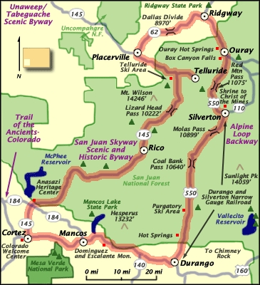
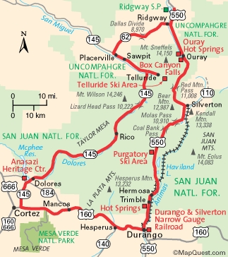
Our bicycle route was the San Juan Skyway -- the dotted yellow line below, clockwise, starting in Durango (bottom of map) -- with a side trip to Mesa Verde National Park. Because of heavy snow, we used other transportation the last two days to complete the 240-mile loop.
Sept. 17: Mancos to Dolores, with side trip to Mesa Verde for bus tour 34 bike miles
Sept. 18: Dolores to Telluride 65 bike miles
Sept. 19: Telluride (hiking) 0 bike miles
Sept. 20: Telluride to Ouray 50 bike miles
Sept. 21: Ouray to Ironton Lake by bike; then to Silverton by Jeep 8 bike miles
Sept. 22: Silverton to Durango by train; then to motel by bike 1 bike mile
TOTAL 190 bike miles
average: 38 bike miles per day on bike days
The maps below show the mountain passes and their elevations.
The passes we biked over were Lizard Head
Pass (10,222 feet) between Rico and Telluride, and Dallas Divide
(8,970 feet) between Placerville and Ridgway.
We also biked about halfway up Red Mountain Pass (11,075 feet), between Ouray and Silverton -- we biked as far as Ironton Lake (9,800 feet). After the bike trip, returning to Denver by car, we drove over Coal Bank Pass (10,640 feet) and Molas Pass (10,899).
We also biked about halfway up Red Mountain Pass (11,075 feet), between Ouray and Silverton -- we biked as far as Ironton Lake (9,800 feet). After the bike trip, returning to Denver by car, we drove over Coal Bank Pass (10,640 feet) and Molas Pass (10,899).